Hope of Israel Ministries (Ecclesia of YEHOVAH):
Locating Ophir -- The Search for the Biblical El Dorado!
|
This article endeavors to conclusively locate the land of Ophir -- the ancient Biblical "El Dorado." It is appropriate to underscore the fact that the exact location of Ophir was in the north-west of Sri Lanka, the place called Mathottam. This area disappeared from the map of the world due to seawater flooding twice and now, with its various cities and villages, lies beneath the Indian Ocean. |
by HOIM Staff
Voyages to "Ophir", a place renowned as a source of large quantities of gold of the finest quality during Biblical times, began during the early days of the First millennium B.C. Even today, this yellowish lustrous metal, known chemically as AU, continues to retain its attraction as a unit of exchange and value. Countries, in their monetary systems, adopted the gold standard, specifying certain weights of gold to equal the value of their currency units.
Earlier, the ancient city of Ur (a prominent Sumerian city in Mesopotamia) dominated the trade in gold and remained an important marketing center in the region. Ur received its large supply of gold from an unknown location below South India -- a landmass considered the holy-land according to the beliefs of the Sumerians.
After the fall of Ur during early Biblical times, Lebanon emerged as a leading gold market in the region. Lebanon received its supply of gold from a location only known as "Ophir". Did Ur, too, receive its gold supply from Ophir? Where is this mysterious land of Ophir located?
Locating Ophir, well known for its abundance of gold during early Biblical times, remains a matter for speculation and continues to draw the attention of scholars, biblical scientists and laymen alike. "El Dorado" -- the fabled city in South America, supposedly rich in treasures, also attracts considerable interest. Unfortunately however, Ophir remains elusive and mysterious to all.
According to the Bible the ancient world went to great lengths to obtain gold, especially during the reign of King Solomon and into the reign of his successors and others in the Middle East. During the reign of Jehoshaphat, one hundred years after the death of King Solomon, frantic attempts were made to reach Ophir for gold -- but the efforts failed to succeed. Numerous lengthy negotiations took place between Jehoshaphat and Ahaziah, the King of Israel, to prepare for a journey to Ophir.
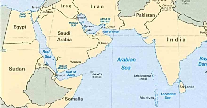
These negotiations failed and his ships were wrecked at Ezion Gebar, the seaport at the head of the Gulf of Aqaba. "King Jehoshaphat built great freighters to sail to Ophir for gold; but they never arrived, for they were wrecked at Ezion Gebar" (1 Kings 22:48). Those events testified to the fact that the region called Ophir lay far away from Israel, and the hazardous voyages involved intense preparations. In addition, the voyage demanded special expertise, technical and professional knowledge and training in navigation.
Bible scientists and historians have attempted to precisely locate the place, advancing fanciful speculations regarding its whereabouts. However, they failed to arrive at any conclusion regarding the exact location of Ophir. According to Biblical information Ezion Gebar, the seaport on the Red-Sea, served as the point of departure for ships that undertook persistent voyages in search of Ophir and its gold. However, up to this time, the location of Ophir has eluded most historians and scientists.
We are now about to embark on a voyage of discovery to finally put to rest the controversy regarding the location of Ophir.
Jews and Israel
For many people, humankind's history, before the coming of Christianity, was primarily the history of the Jews (more correctly, Judahites). The Judahites are the descendants of Abraham, who was born in Ur, one of the oldest Sumerian cities in the old kingdom of Mesopotamia. He left Ur to travel to Haran and finally migrated to Canaan, on the shores of the Dead Sea. The descendants of Abraham spoke a Semitic language called "Hebrew," and worshipped the Creator God YEHOVAH. The word Hebrew means "wanderers". The Bible emphasizes the history of Abraham's people from their time in Canaan. The history of the Judahites and other people is revealed in the pages of the Old Testament, the sacred writings of the Israelite people. Those documents provide interesting and valuable information about the gradual development of human civilization.
Jews (or Judahites) are descended from the ancient tribe of "Judah". The first one to use the name "Judahite" was Jeremiah, the writer of the book of Kings. The Judahites became a people without a king, a city and a Temple. The Persians invaded them in 587 BC, destroyed their first Temple built by King Solomon, and Nebuchadnezzar took the Judahites into captivity in Babylonia. This was considered the beginning of the Diaspora (Dispersion) of the Judahite people, and finally they lost everything in 70 A.D. when the Romans destroyed their Temple and city. They continued to maintain their religious and ethnic identity and their exclusivity. They managed to maintain their identity for more than 2,000 years through the power of YEHOVAH's Word the Bible.
King Solomon (970 BC - 931 BC)
In the first Book of Kings, which begins with the reign of King Solomon (970 BC - 931 BC -- date is to be confirmed), the reference to Ophir first appears. Solomon succeeded his father David (1003 BC - 970 BC). He was outstanding, both for his strengths and weaknesses.
Although there is scant evidence for King David's existence, he appears in the Bible as one of its greatest figures and a model king. He placed himself under the protection of Hiram, the Phoenician King of Sidon. This Phoenician alliance sustained him and is considered an essential element in the greatness of his son King Solomon.
Solomon decided to recast the religion of his people. He continued the alliance with Hiram, who used Solomon's kingdom on the coast of the Hebrew hill country as a means to reach and build shipping-lanes through the Red Sea. Normally Phoenician trading routes went to the Red Sea through Egypt, but during that period the country was in a state of disorder. Therefore, Hiram established a close relationship with both King David and, later, with his son King Solomon.
King Solomon informed Hiram that his father King David was unable to build a Temple to YEHOVAH God due to his bloody past. Solomon conveyed his intention to build a Temple to YEHOVAH, as instructed by the Creator God to his father King David. He appealed to Hiram to assist him with his project. Solomon asked Hiram to send his men to Lebanon to cut cedar timber for him. Hiram agreed to supply both cedar and cypress logs from Lebanon's mountains, convey them to the Mediterranean Sea and float them along the coast according to Solomon's needs.
Solomon laid the foundation for the Temple in May 966 B.C. during the fourth year of his reign, and completed the building in November 959 B.C. in the eleventh year of his reign. He also built his own palace that took thirteen years to complete. King Solomon leaves behind a great literary reputation, centering on "Wisdom." Ascribed to him are the biblical Proverbs, Ecclesiastics, the Song of Solomon and Psalms 72 and 127. When King Solomon died, the combined kingdom of Israel and Judah began to disintegrate. His son Rehoboam succeeded him (931 B.C. - 913 B.C.).
The Bible - 1 Kings
The following excerpts are found in the Bible regarding Ophir, the building of the Temple and the Palace:
"So Hiram gave Solomon cedar and cypress logs according to all his desire" (1 Kings 5:10).
"Also, the ships of Hiram, which brought gold from Ophir, brought great quantities of almug wood and precious stones from Ophir" (1 Kings 10:11).
"And the king made steps of almug wood for the house of the LORD and for the king's house, also harps and stringed instruments for singers. There never again came such almug wood, nor has the like been seen to this day" (1 Kings 10:12).
"King Solomon also built a fleet of ships at Ezion Geber, which is near Elath on the shore of the Red Sea, in the land of Edom" (1 Kings 9:26).
"Then Hiram sent his servants with the fleet, seamen who knew the sea, to work with the servants of Solomon. And they went to Ophir, and acquired four hundred and twenty talents of gold from there, and brought it to King Solomon" (1 Kings 9:27, 28).
"For the king had merchant ships at sea with the fleet of Hiram. Once every three years the merchant ships came bringing gold, silver, ivory, apes, and monkeys" (1 Kings 10:22).
Ophir
The gold, almug trees, gems, ivory, apes, spices, sandalwood and peacocks came to Israel from Ophir. The name of the place, spelt in the English translation of the Bible as Ophir, must have been the product of the translation in earlier years from Hebrew into Greek and later into Latin and English. This essentially contributed to the basic confusion in locating the place. The word "Ophir" is derived from the Greek word "Ophis," meaning a serpent, and some think the word for serpent in Hebrew is also the same. However, the Hebrew word for serpent is "Nachash" or "Saraph" (the Tamil word is Sarpam) and has no phonetic similarity to Ophir. It was the Hebrews and not the Greeks who called the place Ophir, and resorting to the Greek term "Ophis" to determine its location would be an error.
Many Bible scientists are confused over Ophir's location, and no one has confirmed the location with authority. Some have suggested the place to be in South-eastern Arabia, or the Ethiopian coast of the Red Sea. Another suggestion places Ophir in Mashonaland, the ruins of Zimbabwe, between the Zabezi and Limpo rivers. All these suggestions fall short when you realize that a single voyage to Ophir and back took nearly three years to accomplish.
Therefore, the location of Ophir ought to lie very far away -- several thousand nautical miles from the port of Ezion Gerber. Any ship that set-off from Ezion Gerber passed through the Arabian Sea and sailed into the Indian Ocean. Therefore, the location ought to be in the midst of the Indian Ocean.
It has also been suggested that Ophir was located in India, in the regions between the tributaries of the river Indus and China. In addition, some have identified the old seaport of Supara or Sopara, located 40 miles north of Bombay (Mumbai), with the elusive Ophir. The British archeologist Earnest Mackay, first to discover India's earliest civilization, believed that the inhabitants of the cities in the Indus valley sailed to Sumer and other countries in the Mediterranean regions. Thanks to archeological discoveries, the world's oldest seaport of Bombay (Mumbai) -- located in the eastern section of Lothal -- was found to be connected by a seven-meter wide canal from its shipyards to the Arabian Sea. It is a noteworthy fact that Lothal, a city founded 4,000 years ago far south in the Indus valley, is just as old as Mohenjo-Daro. A few Indian historians have made vain attempts to connect Ophir with Supra and Lothal.
The first excavations of the proto-Indian cities in Mohenjo-Daro revealed pictures of ships with masts, and this proved that large ships were available in those early times for long and protracted sea journeys by way of the Arabian Sea. While Ur seemed to be the key entry port into Mesopotamia between 2350 B.C. and 1700 B.C., archeologists found thousands of cylindrical seals in Mesopotamia that belonged to the period between 2300 B.C. and 2000B.C. Many of those cylindrical seals bore inscriptions in the Dravidian language -- the earliest form of Tamil written letters -- which confirms that sea trade to Ur existed from a Tamil area located BELOW the Indian sub-continent. According to available reports, Ur imported various commodities like gold, silver, copper, lapis, lazuli, carnelian, beads, exotic woods and inlay from a location far away from the old city of Mohenjo-Daro.
Dravidian Language -- Tamil
The identification of the sea trade routes with the West, during historical times, has been greatly facilitated by references in the remarkable Periplus of the Erythraen Sea of the First century A.D. When studying the Periplus, one may note that several places, cities and ports are recorded in the Dravidian language known as Tamil.
"A number of South Dravidian words, almost all of them geographic and dynasties names, occur in such Greco-Roman sources as Periplaus maris Erythrael (circumnavigation of the Erythraen sea) of 89 AD, and in the writing of Ptolemaeus of Naukratis of the 2nd century AD; it is probable that the Western language term for rice (compare Italian riso, Latin oryza, Greek oryza) and ginger (compare Italian zen zero, German ingwer, Greek zingiberis) are cultural loans from Old Tamil, in which they are arici and inciver, respectively." (The New Encyclopedia Britannica, Volume 4, 15th Edition, page 699).
Early Mesopotamians used Tamil words to name places during ancient times, such as "Ur" means settlement, town or community and there are many words with Ur in the root, such as "Uruk", "Nimrud", etc.
Furthermore, in the Hebrew Bible (1 Kings 10:22) ivory, apes, ahalim and peacocks arrived at the Israeli port. In the original Hebrew they are referred to as: Ivory -- shen; apes -- kapi; ahalim -- aghil, peacocks -- tuki. These four are Tamil words.
When reflecting on the need to adapt the Tamil words in the original Hebrew of the Bible, it becomes necessary to turn our attention to the word "Ophir." The Tamil word "Ovar" means, painters, artists, sculptors, engineering technicians, artisans, and skilled workers in the construction trade. The country of the Ovar was also called "Oviyar Nadu" -- the ancient land of Oviyar. Artisans, or skilled craftsmen, were called Ovar by the foreign sailors, and that was also the adapted name of the seaport in the northwestern coast of Ilanka (Lanka).
Now, it is appropriate to point out that the word "Ovar" was corrupted by foreign sailors due to the proclivity of their tongues, and came to be called Ophir -- the country of the Oviyar. This Oviyar land was mainly populated with the tribe of the Nagas, who lived in and around Mantai (Mathottam, the greatest emporium), a port city in the northwestern part of Lanka, as will be seen in the Cirupanarrupadai, one of the ten idylls of the old Tamil Academy (Sangam) period.
The Oviyar were a tribe of Nagas, inhabiting the sea coast of Lanka. According to the Cirupanarrupadai Aghil (incense) and sandalwood, being used to wash the bodies of damsels, shows that the place was a port and that those articles had dropped out of the ships (Cirupan, 11:161. 221).
The Nagas were of Tibeto-Burman origin, and by about 4000 B.C. they were driven by some political disturbances from Central Asia into India, through the northeastern frontier. The Nagas were a prominent non-Aryan race in India and their names are still preserved in various parts of India.
Ptolemy in his Geography, written in the middle of the 2nd century, named Mantai as Modouttou, which was the entry port for sea trade in the Indian Ocean. In addition, in the pre-historic days, it was a famous international emporium. The phonetic similarity between Ophir and Oviyar is certainly striking, and Ophir must have been borrowed in the same manner as the Hebrew words for ivory, apes, aghil and peacocks -- ibha, kapi, ahalim and tukeyium respectively, which are identical with their Tamil words -- ipam, kapi, aghil, and tokai. The Hebrew mariners, no doubt, borrowed the words from the Tamil inhabitants of the port area.
Sri Lanka, from the pre-historic period and from the days of Iramayanam (Ramayana), was known as "Ilanka" meaning the "resplendent land." But it also received several other names by different nationalities. The Arabs called Ilanka "Serendib", the Portuguese "Ceilao", the Sinhalese "Sinhala Dwipa", the Tamils used the original name of "Illam," "Elam," "Eelam," or "Eelanadu," and the Thas added the honorific Tewa, calling the land "Island of Tewa Lanka" (divine Ilanka), and the Greeks called it "Taprobane." Ptolemy thought that "Simondou" was the old name of Ilanka, but according to the Periplus Ilanka was then known as "Palaisimoundon" -- Paliya Seela Mandalam (old virtuous region). "Telmun," or "Dilmun," was the name given to it by the Sumerians of Ur. In 1972, the country's name was changed officially from Ceylon to Sri Lanka.
The ancient Hindu epic Iramayanam represents Ceylon (Ilanka) as a huge continent -- a tradition not unsupported by science. The description in the Iramayanam about Irama (Rama) crossing the peninsula and conquering Ilanka is a clear indication of Aryan (meaning outsiders) penetration into the south part of the Indian peninsula.
According to the Sri Lankan Buddhist chronologies, such as the Dipavamsa, Mahavamsa, Rajavaliya etc., Ilanka had been the abode of Asuras -- demons and Yakkhas (the devils). Ausras in Tamil means A+Sura. Sura means those who drink alcohol to excess, and Asura means the teetotaler. Buddhist chronicles refer to the Asuras and Yakkhas as the aboriginal people of the country -- the descendants of the devout Hindu and the descendants of Iravanan (Ravana), the Tamil King of Ilanka.
Earlier, the Aryan poet Valmiki -- a robber turned ascetic who wrote the Iramayanam in Sanskrit -- described the indomitable Tamil aborigines of Ilanka with contempt, calling them Rakshasas -- monsters, demons and cannibals. Rakshasas, according to popular Indian belief, are malignant beings, demons of many shapes, terrible and cruel, which disturb the sacrifices and the religious rites of the Brahmans. It appears that the poet of the Iramayanam, vociferous in his vitriol, applied the hated name of Rakshasas to an abhorred and hostile people.
The groups found in Dipawamsa, Mahavamsa and Rajavaliya are an expression of his hatred and horror rather than a very historical name for a sect of people. Pali and Sinhalese writers of the ancient Buddhists chronicles used these derogatory terms when referring to the descendants of the original inhabitants of the country -- the Tamils. In earlier days the Aryan ascetics, not necessarily Brahmans, served as pioneers and spies against non-Aryans -- the Dravidian -- whose forests they occupied without permission, thus being a major cause of the Aryan movement to the south.
However, it is clear that ancient writers from the Pali, Sanskiritic and Sinhala languages used scolding epithets such as Asuras, Rakshas and Yakshas.
The term Yakshas means Devils who can transmigrate and transform themselves to any shape or size, and was used to denote the Dravidian -- the Tamils -- who were the enemies of the Aryans, who for a long time resisted the progress of the pale-skinned race into the Indian sub-continent. The Tamils were were contemptuously called Asuras (teetotalers), Rakshas (Protectors of the Dravidian race and faith), Iyakkhas (the archers) and Yakkhas (devils in the Sinhala language) because of their physical strength, courage and valor, and super natural powers ascribed to them by the early Aryans. The Dravidians established a powerful kingdom in Ilanka and asserted their authority over the Dekkan plateau and other parts of South India.
Southward Movement
However, according to the historical evidences and judging from the southward movement of the Aryans (generally dated around 1100 B.C. to 900 B.C.), one has to conclude that the original Iramayanam must have been composed at least fifty or hundred years later. Therefore, it is historically correct to assume that the Irama-Iravanan war occurred in ancient Ilanka -- around the period of the Aryans' southward movement.
The Iramayanam depicts the southward movement of the Aryans in detail. However, the Iramayanam relates the story of the abduction of Sita -- the spouse of Irama -- by the South Ilanka king, Iravanan. When Iravanan was the ruler of southern Ilanka, the Naga tribe (who were "Ovar" or artisans of the highest order) ruled the northwestern portion of Ilanka. The "artisans" tribe originated from their chief Viswakarma, the divine architect. The five classes of artisans, namely Manu -- blacksmiths, Maya -- carpenters, Tuvashta Kannar -- brass founders, Silpa Sirpi -- masons, stone-cutters, sculptors, architects, image makers and painters, Visvanna -- goldsmiths, are said to have been born out of the five faces of Viswakarma.
Although, their country was known as Mathottam, and the capital called Mantai -- the port city -- the whole country was popularly known as "Ovar" or "Oviyar Nadu", meaning the land of the divine craftsmen. Ravana's spouse Mandotari was the daughter of the Mayan the king of this country. Several thousands of years ago a great Shiva devotee constructed a temple for Shiva in this region at Tirukethiswaram (Tashis) . The lord of the temple, was called, "Obanna."
The artisans of Oviyar Nadu also possessed the skill to build aircraft. King Iravanan used an aircraft (dirigible) called "Puspakavimanam," to abduct Sita, and that too was built by the craftsmen of Ovar. At the entry port of Ovar, the busiest one in the region, ships from various countries used to call for gold, silver, copper, exotic woods, pearls, spices, and other luxurious items grown, manufactured and mined in and around Ovar. Similarly, King Solomon's ships called at the seaport of Ovar, for exotic cargoes required for the building of YEHOVAH's Temple and Solomon's palace in Jerusalem.
In our effort to locate Ophir we need to confirm the availability of gold and silver in Ilanka.
The Phoenician History of Sanchoniathon is the earliest record available regarding the kingdom in north Ilanka. Sanchoniathon lived before the Trojan War. According to him, "Four kings governed the Island (Ilanka), all subordinate to a paramount sovereign, to whom they paid tributes, cassia, ivory, gems, and pearls, for the king has gold in abundance." Further more, Ptolemy in his great work entitled Geography of the World, complied in 150 A.D., writes as follow in Bk. Vii, Chap. IV, Sect. 1 --
"Opposite Cape Cory, which is in India, is the projecting point of the Island Taprobane, which was called formerly Simoundou and now Salike. The inhabitants are now called Salai. Their heads are quite encircled with luxuriant locks, like those of women. The country produces rice, honey, ginger, beryl, and hyacinth and has mines of every sort of gold, silver and other metals. It breeds at the same time elephants and tigers."
The above two descriptions should clarify the availability of gold and silver in Lanka (Ilanka), during those days. Ptolemy went a step further to testify that gold and silver were mined in Ilanka.
Even Pliny the Elder in his Natural History, while referring to Taprobane, writes:
"Megasthenes says that Taprobane is divided by a river and that the natives are called Aborigines (Palegoni -- born long ago) and produce more gold and larger pearls than the Indians."
Megasthenes was an envoy of Seleucus Nicator, founder of the Syrian monarchy. Megasthenes wrote his work on India (Indika) as a result of his experience while being ambassador to the king of Prasii.
Voyage for Gold
Available historical information reveals that only once did King Solomon and King Hiram's sailors jointly sail successfully to Ophir. This voyage for gold must have happened during or just after lifetime of Iravanan. According to the historical information, a great part of Ilanka was submerged under the sea following Iravanan's failures in the war with Irama. Rajavaliya describes the aftermath of the war as follows:
"Be it known that, by his (Iravanan's) wickedness, his fortress, 25 palaces and 400,000 streets were overwhelmed by sea."
This deluge took place in the southern and northwestern part of Ilanka.
Subsequently during the Second Century B.C., and again according to Rajavaliya, 100,000 seaport towns, 970 fishers' villages, 470 villages of pearl-fishers, making altogether a large portion of Ilanka, was submerged by the sea when Kelanitissa was the King of south Ilanka. According to Eratosthenes the dimension of the island was 804 miles in length and 575 miles in breadth in the 2nd century B.C. Llanka today, however, is only one-twelfth the size of the Ilanka of ancient days -- minus the gold prospecting region of Ophir. The actual measurements of the present island of Sri Lanka are 271 X 137 miles.
After the death of Solomon and Hiram, no other successful expedition to Ophir took place. Unfortunately, King Hiram and his own talented sailors were the only group of mariners who were able to locate Ophir in the north-west of Ilanka. After their passing, and when the Biblical Ophir disappeared beneath the sea, firstly after the Iravanan debacle and later during the reign of Kelanitissa, people continued to speculate about, and tried to locate, the land that was no more.
Subsequently, during the few centuries before the Buddhists and Christian eras, the sea trade along the coast of Ilanka and in the Indian Ocean remained in the hands of the Arabs, who jealously guarded their routes against encroachment by other nations. They disseminated fabulous and blood curdling stories of the dangers of navigation to frighten away would-be discoverers.
The monopoly of the Arabs in the Indian Ocean was shattered in the latter part of fifteen century AD. After Vasco da Gama discovered India in 1498 European colonialists set their sails to conquer the countries of Asia. The Baobab trees that are a notable feature in the landscape of the Gulf of Mannar and the present Mathottam areas, testify to the Arab's ancient settlements during those periods.
In conclusion, it is appropriate to underscore the fact that the exact location of Ophir was in the north-west of Sri Lanka, the place called Mathottam. This area disappeared from the map of the world due to seawater flooding twice and now, with its various cities and villages, lies beneath the Indian Ocean.
Based on the above true location of Ophir the world should put to rest any further search for its location but, however, should consider initiating geological surveys for gold and other precious metals in and around and off the coast of the north-west region of Sri Lanka.
|
Hope
of Israel Ministries -- Taking the Lead in the Search for Truth!
|
|
Hope of Israel Ministries |
 |
Scan with your Smartphone for more information |